
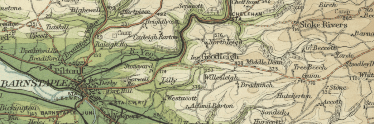
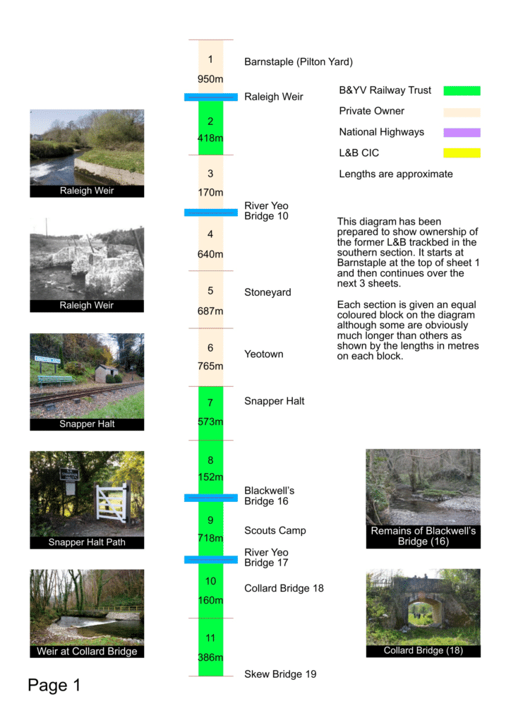
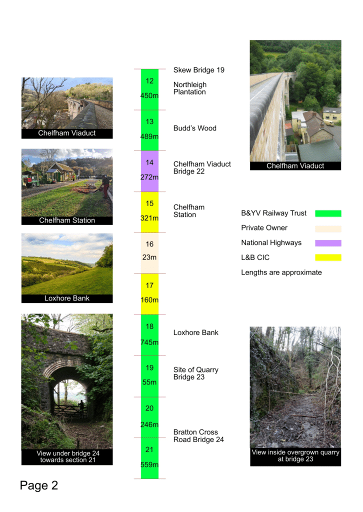
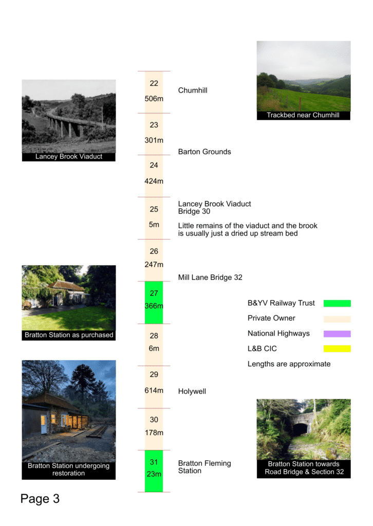
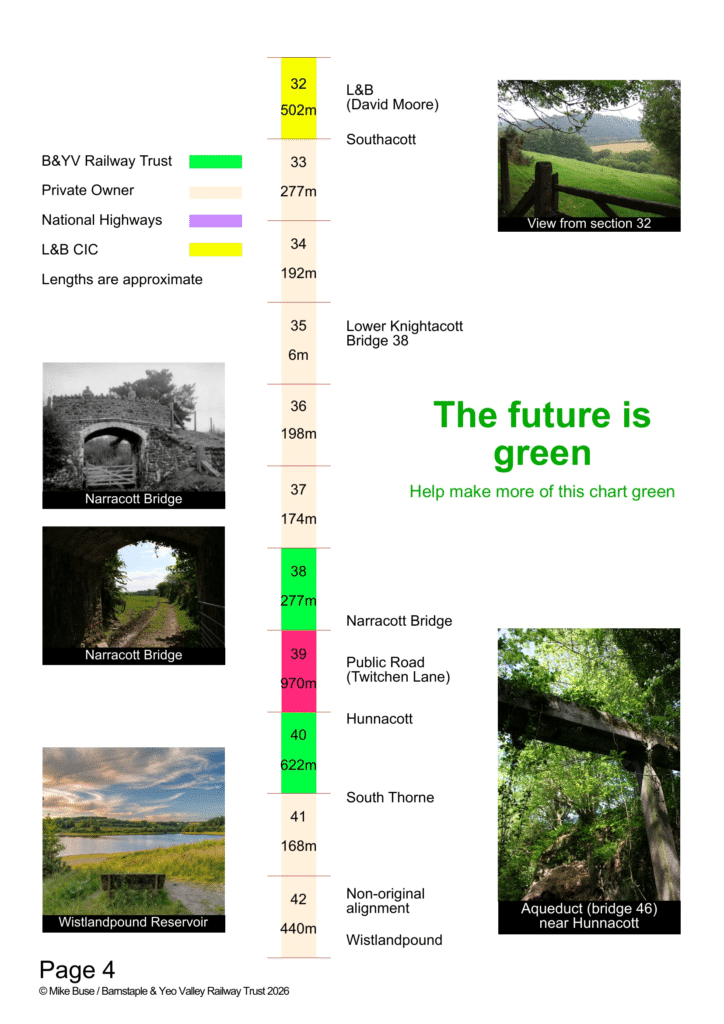
Since 2002, Exmoor Associates and, more recently, Barnstaple & Yeo Valley Railway Trust have been slowly and steadily acquiring the former trackbed of the Lynton & Barnstaple Railway between Barnstaple and Wistlandpound. These maps (last updated May 2026) show (South to North) the progress to date, and the sections still to be acquired.
PLEASE NOTE: Most of the trackbed is currently not publicly accessible. Please do not attempt to gain access without specific permission.


As of 1st September 2026, the total length of trackbed between Pilton in Barnstaple and Wistlandpound Reservoir is 15.435 kilometres/9.59 miles (subject to detailed survey). Of this, 6.390 km/3.970 mi (41.4%) is owned by B&YVRT, 0.983 km/0.610 mi (6.37%) is owned by L&BRT, 1.242 km/0.771 mi (8.047%) is owned by statutory bodies. This leaves 6.820 km/4.237 mi (44.19%) in private ownership.
Links to a range of modern and contemporary L&BR-related maps and mapping projects are available at More Maps